Distance Grids
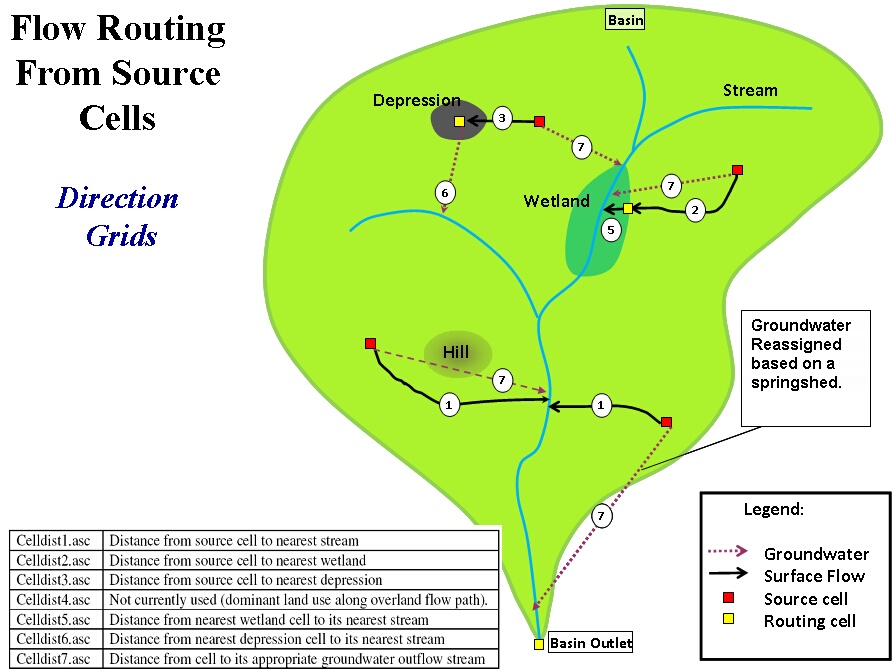
The distance from the source cell to the closest hydrological feature is an important piece of information for determining the attenuation that occurs in the runoff or percolation originating from a source cell to enter the nearest hydrologically downstream reach within the stream network. A number of GIS feature classes (Figure 1.4) are used to determine the flow path and distance that runoff and groundwater will follow. The distances for runoff and groundwater flow are independent. Distances for surface flow are not Euclidean (Figure 1.5), but weighted based on gradients determined by the surface topography and sub-basin boundaries, which flow cannot cross. Distances for groundwater flow are Euclidean and are limited by springshed boundaries, if such information is available.
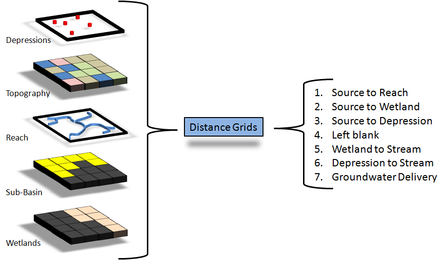
For runoff, the closest hydrologic feature (reach, depression or riparian wetland) to the source cell is located. If the initial destination is a depression, then the runoff flow is converted to groundwater at the depression and then routed to the closest reach from that feature. If the initial destination is riparian wetland, then the runoff flow is routed through the wetland to the closest reach from that feature. WAM tracks the distance between 6 features, as listed in the figure below. If springsheds are known, they can be used to override the delivery of groundwater flows and direct flow to known springs, whereby, bypassing the nearest reach.